Exif Tab
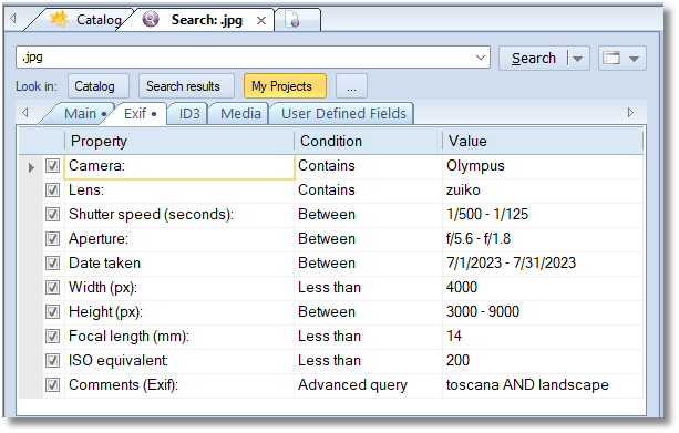
If any of the conditions from the Exif tab is turned on, only files having Exif tags will be displayed in the search results. If the file have no Exif fields, it will not be shown.
| Property | Conditions | Description |
|---|---|---|
| Camera | Contains, Advanced query | search in the “camera make” and “camera model” Exif tags. |
| Lens | Contains, Advanced query | search in the “lens”, “lens maker notes”, and “lens make” Exif tags. |
| Shutter speed (seconds) | Less than, Equal to, Between, Greater than | searching by the shutter speed value. To modify the Value cell, click inside the cell, then click the ellipsis button: 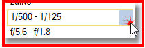
|
| Aperture | Less than, Equal to, Between, Greater than | searching by the Aperture value. To modify the Value cell, click inside the cell, then click the ellipsis button. |
| Date Taken | Before, On, After Between | searching by the Date Taken Exif field value. |
| Width (px), Height (px) | Less than, Equal to, Between, Greater than | searching by the height and the width (in pixels) taken from Exif tags. |
| Focal length (mm) | Less than, Equal to, Between, Greater than | searching by the Focal Length value. |
| ISO equivalent | Less than, Equal to, Between, Greater than | ISO equivalent. |
| Comments (Exif) | Contains, Advanced query | searching by the Comments grabbed from Exif tags |
| Has GPS coordinates | Yes/No | separates geotagged photos from the rest of the collection. Select “Yes” to find only the photos that carry GPS coordinates, or “No” to find the photos that do not. |
| Within a distance of a place | within | finds everything shot within a given radius of a spot. To set the place and the radius, click inside the Value cell, then click the ellipsis button. See the “Searching by Location” section below. |
Searching by Location
WinCatalog reads the GPS coordinates written by the camera or the phone into the photo and lets you search by them offline: no internet connection, no account, and nothing about your collection leaves the computer.
Coordinates are grabbed from regular images (JPEG, HEIC, TIFF, WebP) and from RAW files during the scan. If a photo was added to the collection by an older version of WinCatalog, update the disk to make its coordinates searchable.
Has GPS coordinates
The simplest of the two conditions: it just asks whether the photo carries coordinates at all.
- Yes — only geotagged photos are shown. This is the quickest way to see what part of the collection can be placed on a map.
- No — only the photos without coordinates are shown, which is useful when you are looking for the shots that still need to be geotagged by hand.
Cameras that failed to get a satellite fix sometimes write zeroes instead of real coordinates. WinCatalog treats such photos as having no GPS data, so they never show up as false positives.
Within a distance of a place
This condition finds everything shot around a given point: select the place, set the radius, and the search returns the photos taken inside that circle.
Clicking the ellipsis button in the Value cell opens the place picker, which offers three ways to set the point:
- A place from your collection. The picker lists the places where your photos were actually taken, each with the number of photos, for example “Paris, France (58 photos)”. Places are named using an offline database of world cities, so when a spot is far from any city it is shown honestly as, for example, “14 km from Salzburg (23 photos)”. Nothing is downloaded — the list is built from the coordinates already stored in your collection.
- A city. The same offline city database can be used to pick a place your collection has no photos of yet.
- Coordinates. Paste the coordinates directly, in the
48.8583, 2.2944form produced by the “copy coordinates” command of the online maps, or in the degrees-minutes-seconds form.
The radius is set in kilometers or in miles, depending on the regional settings of your computer: WinCatalog uses miles where the locale is imperial and kilometers everywhere else.
Related commands
Two commands in the right-click menu of a photo complement the search conditions:
- Show on map — opens the place where the photo was taken in the browser.
- Find photos taken nearby — starts a “Within a distance of a place” search centered on the selected photo, without setting the place by hand.
The Place and Map link rows of the properties panel show the same information for the selected photo, and the %gps_city% and %gps_link% tokens make it available as Dynamic Columns.